

Blitz Bureau
NEW DELHI: In a monsoon that has tested the country’s disaster-response systems week after week, the value of watching from above is easy to see. The Indian Space Research Organisation is readying EOS-05, an Earth-observation satellite also known as GISAT-1A, for launch aboard a GSLV Mk II rocket from the second launch pad at the Satish Dhawan Space Centre, Sriharikota, in a window around July 31. Weighing roughly 2,100 kilograms, the spacecraft is designed for a geostationary orbit — a vantage point from which it can keep near-continuous watch over the Indian landmass rather than passing overhead only intermittently.
That orbit is the point of the mission. From geostationary height EOS-05 can deliver high-resolution multispectral and hyperspectral imagery on demand, supporting the monitoring of agriculture, forests, water resources and urban growth — and, most usefully in a season like this one, natural disasters as they unfold. A satellite that can be tasked to look at a specific flooding valley or a swelling river within minutes, rather than on the next scheduled pass, turns Earth observation from a mapping exercise into a real-time instrument of response.
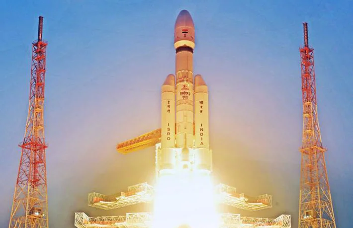
A standing watch from orbit: EOS-05 (GISAT-1A), a roughly 2,100 kg geo-imaging satellite, is being prepared for a GSLV Mk II launch from Sriharikota around July 31 — built to image the Indian landmass on demand for agriculture, water and disaster monitoring.
A satellite that watches continuously is not a luxury for a country of monsoons and mountains. It is the difference between reacting to a flood and seeing it coming.
At a Glance
• Mission: EOS-05 (GISAT-1A) geo-imaging Earth-observation satellite
• Launch: GSLV Mk II from Sriharikota’s second pad, window around July 31
• Mass: about 2,100 kg, bound for geostationary orbit
• Use: on-demand imaging for agriculture, water, urban growth and disasters
The mission also fits a busy and deliberately sequenced year for ISRO. The agency is building toward the uncrewed Gaganyaan G1 test flight in the third quarter of 2026, having recently cleared a series of crew-module qualification tests, while continuing a steady cadence of Earth-observation and communication launches. Each flight adds capability that compounds: the geostationary imaging EOS-05 provides slots alongside the polar-orbiting satellites already in service, giving disaster managers both the wide, frequent sweep and the fixed, continuous stare.
The constructive payoff is measured on the ground, not in orbit. Better imagery reaches its full value only when it flows quickly to the district officers, disaster-response forces and farmers who act on it, which makes the data pipeline — fast tasking, rapid processing, plain-language alerts — as important as the satellite itself. India has built one of the developing world’s most capable space programmes at a fraction of the usual cost; turning that capability into faster warnings and better-planned harvests is the way forward that makes every launch pay for itself many times over.