

Blitz Bureau
NEW DELHI:
A year ago today, a GSLV rocket lifted off from Sriharikota in the late afternoon carrying the most expensive Earth-observation satellite either of its two builders had ever flown. NISAR — the NASA-ISRO Synthetic Aperture Radar — was designed to do something no civilian mission had attempted at this scale: image the planet’s entire land and ice surface every twelve days with radar precise enough to detect ground movement of a few millimetres. Twelve months on, the mission has moved from commissioning to output. The first global public data release began on July 20, covering observations acquired from June 17 onward.
The instrument’s usefulness comes from what radar can do that a camera cannot. Optical satellites need daylight and clear skies, which in practice means they are blind over India for large parts of the monsoon — exactly when the country most needs to see its own land. Radar works through cloud and at night. And because NISAR measures the phase of the returning signal rather than merely brightness, comparing two passes over the same ground reveals whether the surface has risen or subsided in between, down to millimetre scale. Early results have demonstrated the capability convincingly, including mapping how parts of Mexico City are sinking under groundwater extraction and soil compaction, and resolving structure hidden beneath Antarctic snow and ice.
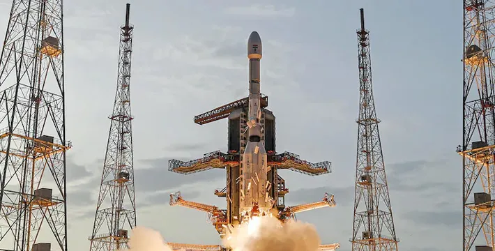
Built by two agencies, flown by one: NISAR reached orbit on an Indian GSLV from Sriharikota a year ago, and now returns dozens of terabytes of radar data a day.
A camera tells you what the land looks like. This radar tells you whether it is moving — which, for a country with India’s geology, is the more urgent question.
At a Glance
• Launched: July 30, 2025, on a GSLV from the Satish Dhawan Space Centre, Sriharikota
• Partners: ISRO and NASA — a joint Earth-observation mission
• Coverage: global land and ice surfaces, including islands, sea ice and selected oceans, every 12 days
• Data: first global public release began July 20, 2026, covering observations from June 17 onward
• Volume: dozens of terabytes generated each day
• Demonstrated use: millimetre-scale subsidence mapping; structure beneath Antarctic ice
• Design purpose: land and ice deformation, land ecosystems, and oceanic regions of shared interest
For India specifically, the applications map onto problems the country already knows it has. Groundwater over-extraction causes measurable land subsidence, and a satellite that can see a city sinking is a satellite that can tell a state water board which aquifer blocks are being drawn down fastest — independent of whether anyone is reporting it. Landslide-prone Himalayan slopes creep for weeks before they fail, and that creep is exactly what radar interferometry detects. Embankments, dams, highways and rail formations deform slowly before they crack. Crop biomass and soil moisture can be estimated through cloud, which is worth a great deal in a monsoon country trying to forecast its own kharif output.
The constructive challenge is now on the ground rather than in orbit. Dozens of terabytes a day is only valuable to the extent that Indian institutions can ingest, process and act on it, and that requires trained analysts, computing capacity and — most of all — standing arrangements that put the data in front of the agencies that make decisions: state groundwater boards, disaster management authorities, the National Highways Authority, agriculture departments. The forward path is to build a small number of well-funded national processing centres with an explicit mandate to convert NISAR data into district-level products, and to make those products open by default so that state governments, universities and Indian start-ups can build on them. India helped build and launched one of the finest scientific instruments in orbit. Year two is about making sure the country reads what it sends home.